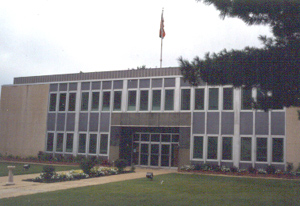
Henderson County
The Tennessee General Assembly created Henderson County on November 7, 1821, and named it in honor of Colonel James Henderson, who served under Andrew Jackson and commanded Tennessee troops at the battle of New Orleans. Several of the county's early settlers served under Henderson's command during the War of 1812 and during the Natchez and Creek Indian campaigns. The original area contained the present county, a large part of Chester County, and smaller portions of Decatur and Madison Counties. Major John Troxell Harmon surveyed the county seat of Lexington in 1822 and laid out the town facing northeast, making it crosswise to traditional orientation. At 720 feet, Lexington is also highest in elevation of all the West Tennessee county seats.
The Tennessee Highland Ridge (also known locally and historically as Feather Ridge and Purdy Range) divided the county into two distinct cultural and geographical sections. All water falling east of the ridge flows to the Tennessee River, while water west of the ridge flows to the Mississippi River. The Tennessee Highland Ridge enters Henderson County at the Chester County line near Laster, separates the Middlefork and Palestine communities, and follows a northerly pattern west of Lexington across Sand Ridge between Bargerton and Union Cross before entering Carroll County. Most of the plantation and slave-owning settlers of the county lived west of the ridge, where the ground was less hilly. The land east of the ridge becomes increasingly hilly toward the Tennessee River and was largely unsuitable for plantation farming.
Three rivers, the Beech, the White Oak, and the Forked Deer, drain Henderson County. Nine recreational lakes dot the county, including two within Natchez Trace State Park. The trace that gives the park its name was a route used on the western side of the Tennessee River. Though not as famous as its Middle Tennessee counterpart, this trail proved just as important to the area's early settlement and economic development. Today, the park contains forty-eight thousand acres, making it one of the largest in the state park system. Within the park is one of North America's largest pecan trees. The park offers hiking trails, camping and picnic sites, opportunities for swimming and fishing, and playing fields.
In 1823 Middle Fork Primitive Baptist Church became the first organized congregation in the county. It was followed by Jacks Creek Baptist Church in 1828, Mud Creek Primitive Baptist in 1830, Mt. Gilead Cumberland Presbyterian in 1826, and a Methodist Church near Olive Branch in 1832.
Mifflin, now in Chester County, was the earliest and largest of the settlements in Henderson County and the site of the first county commission meetings until the surveying of Lexington. Lexington has been the home of four courthouses. One burned during the Civil War, and another was destroyed by fire during the 1890s, leaving the county with few early records. Governor William Carroll appointed the first commissioners: James Baker, John Crook, John Essary, John Haliburton, Jere Hendricks, Dewey Middleton, John Purdy, William Ray, Abner Taylor, John Wilkes, and Samuel Wilson. Jere Hindricks was the first executive. John Purdy surveyed the first roads, and the original county seat of McNairy County, Purdy, was named in honor of him. The first sheriff was John Troxell Harmon.
The county supplied regiments for both sides during the Civil War, with the western portion of the county following the Confederacy, and the areas east of the Highland Ridge remaining with the Union. County Confederate units were attached to the 13th, 27th, 51st, 52nd, and 154th Confederate infantries, and the 18th, 21st, and 55th Southern cavalries. Both Lexington and Parkers Crossroads were battle sites during General Nathan Bedford Forrest's West Tennessee campaign of 1862. Parker's Crossroads Battlefield is listed in the National Register of Historic Places and has interpretive signs explaining the course of events during the battle. The Federals organized six companies in the 7th Tennessee Cavalry. In later years, these areas organized politically along the same lines, with former Confederate areas voting Democratic and former Union areas supporting the Republican Party. In the last few decades, much of this historic separation and adherence to old alliances has eroded, but regional voting patterns still can be discerned.
In the course of its history, Henderson County has been the site of a number of mysteries and oddities. Stories have long circulated that a large amount of gold was buried and lost by Federal troops on Owl Creek near Lexington. Various outlaws and gangs, including John Murrell and the Moore Gang, roamed the countryside from the 1830s through the 1870s. Henderson County was the site of a turn-of-the-century resort called Hinson Springs. And one of the world's largest men, Mills Darden, is buried near the Chapel Hill community.
In 2000 Henderson County contained 25,552 people; incorporated areas include Lexington, Parker's Crossroads, Scotts Hill and Sardis. Other villages include Huron, Luray, Life, Crucifer, Broadway, Juno, Blue Goose, Poplar Springs, Independence, Union Cross, Rock Hill, Chesterfield Darden, Safford, Middleburg, Shady Hill, Reagan, Cedar Grove, Hickory Flats, Union Hill, Lula, Stegall, Center Hill, Wright Town, Garner Town, Farmville, Moore's Hill, Warren's Bluff, and Stringtown. Henderson County lost the villages of Jacks Creek, Clarks Creek, Mifflin, Roby, and Center Point in 1882 with the creation of Chester County.
With easy access to Interstate 40, Henderson County has turned from agriculture to industrial development. The largest employers in the county, Johnson Controls and Leroy-Somer in Lexington, have a combined employment of over eighteen hundred workers. The county has one hospital, two nursing homes, and ten schools. Over 60 percent of the county's high school graduates receive some postsecondary education, with many attending area colleges and technical schools.


